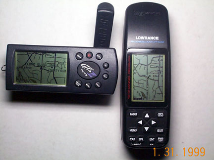
Comparing Features of the Garmin G-12MAP, G-III+
and the Lowrance GM-100
[Garmin Roads &
Recreation CD] * [Lowrance CityStreets CD]
(7 September 1999, added information for G-12MAP)
MapSource * MapCreate
G12Map G-III+ * GM-100
Alarm, audible
Y N
Y
Altitude displayed is height above WGS-84 mean sea level
Y Y
N
Battery life, hrs (normal mode)
24 20 1/2 8 1/2
Battery compartment, sealed with rubber gaskets
Y Y
N
Battery door, attached to GPS
Y Y
N
Database, of streets and roads most up to date
Y Y
N
Datums, number
108 106 191
Event markers (icons only)
0 0 1000
Lithium backup battery, protects data w/o AAs for:
3 months 3 months 10 years
Map, Positioning Feature
N N
Y
Map, can be shown at any waypoint (automatically)
Y Y
N
Map (CD), can be printed from PC
Y Y
Y
Map memory, capacity (MB)
1.4 1.4 2.0
Map features, selectable when uploading to GPS
N N
Y
Map program, automatically selects fastest GPS baud rate
Y Y
N
Map on screen, two can be shown at same time
N N
Y
Map Software: More 3rd party available than any other brand
Y Y
N
Moonrise/set data
N N
Y
Nav aids and points of interest, shown on inland rivers/lakes
Y Y
N
Nav aids, nautical provided sufficient for coastal navigating
N N
Y
Price, (Approx. Street) with street-level CD
$410 $430 $450
Receiver weight
269g 260g 344g
Roads, major ones are highlighted in black
Y Y
N
Route, presentation in 3D
y Y
N
Routes, number of
20 20 99
Screen, rotatable
N Y
N
Screens, shades of gray
4 4
3
Shoreline, vector resolution equal to that of Street Atlas 5
Y Y
N
Street map, vector-resolution equal to that of Street Atlas 5
Y Y
N
Street names, shows all shown by Street Atlas 5
Y Y
N
Street names displayed by "Point and Read" requiring no zooming
Y Y
N
Temperature >Low operating temperature range
5F 5F ?
>High operating temperature range
124F 124F ?
Topographic data (CD), provided for off-road navigating
Y Y
N
Trackpoint, capacity in active track
2000 2000 3000
Trackpoint, capacity per saved track
250 250 3000
Trackpoint interval, automatically selected for efficient storage
Y Y N
Tracks saved, number available
10 10 2
Track trail display, flashes for easy identification
N N Y
Track trail display, connects un-related tracks with bogus lines
N N Y
Waypoint, storage capacity
500 500 750
Waypoints, lists bearing and distance to closest:
9 9 20
Zoom levels, number of:
23 23 32
�
Jack
Yeazel Ron
Wilson